Blog Layout

8 Queensland Waterfalls in 8 hours

Annette Green • Dec 02, 2019

How to see eight waterfalls in under eight hours on the Atherton Tableland

Today I'm going to tell you how to see eight epic waterfalls in less than eight hours and on a route of less than 150 kms in total return. The waterfalls I have chosen are on the Atherton Tableland in Queensland.

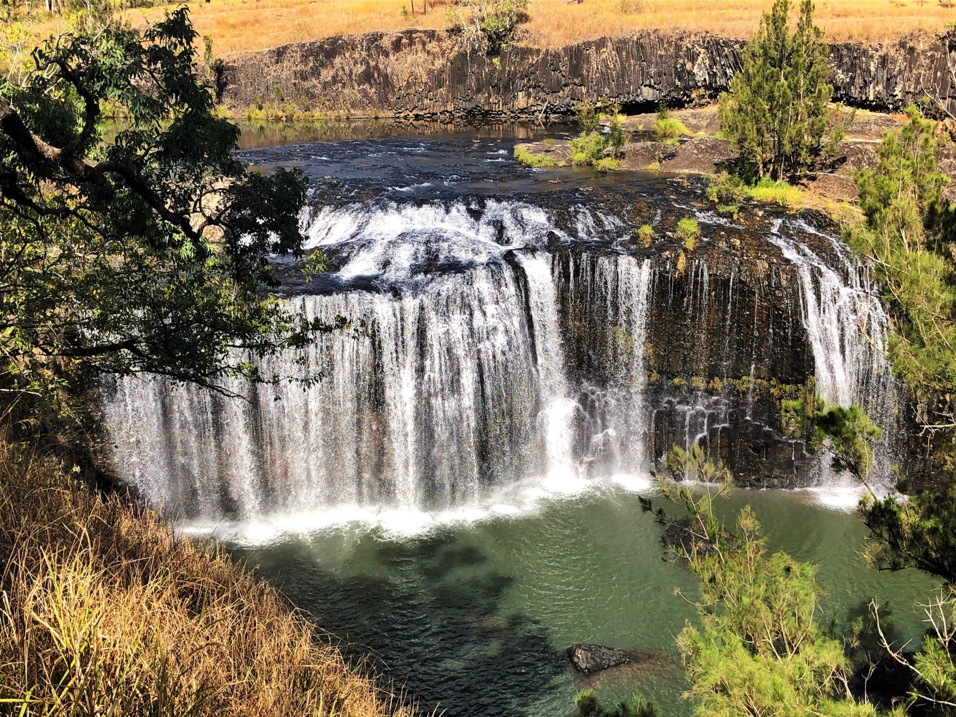
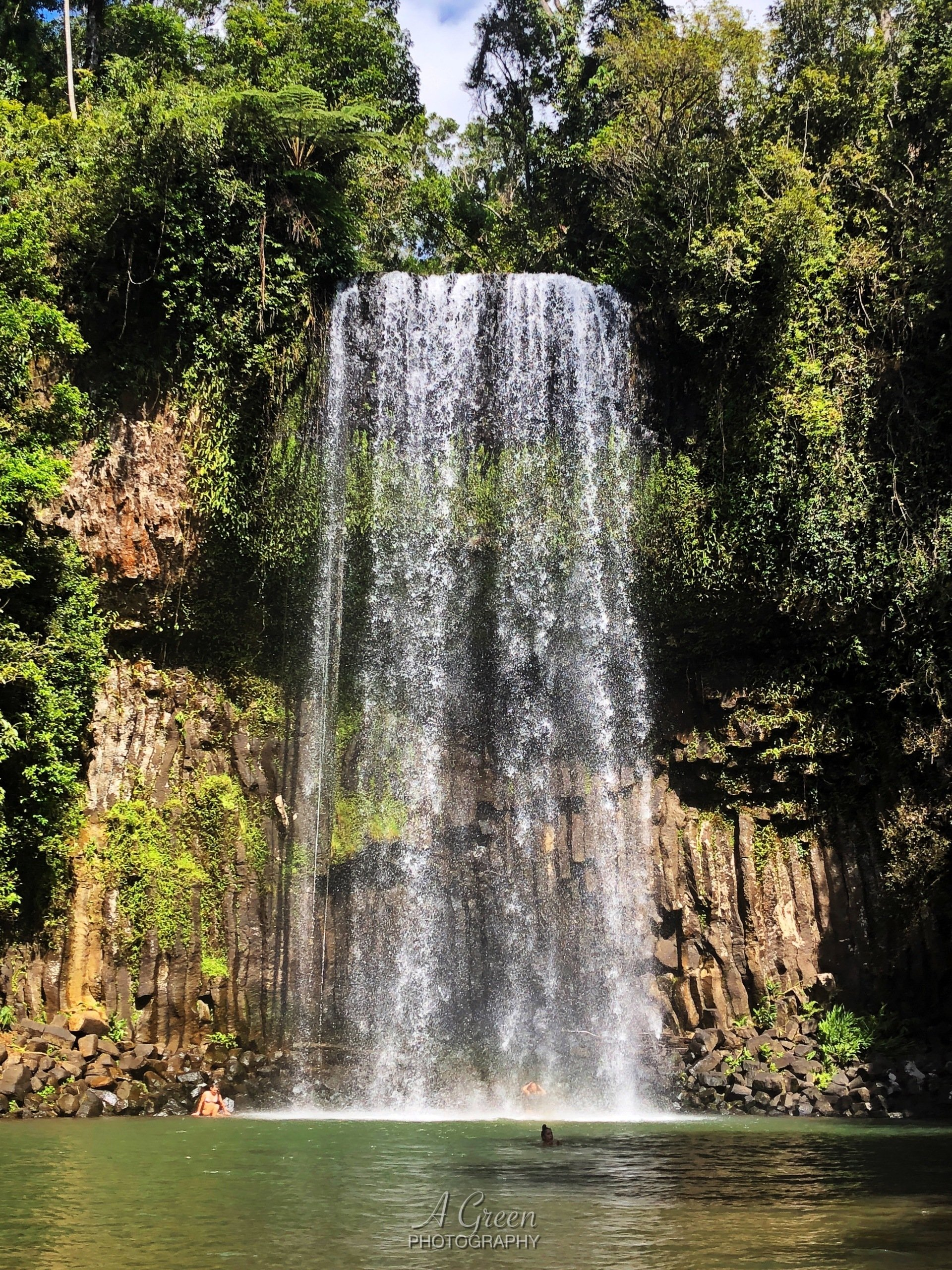
Firstly you need a base starting point.  I have chosen the Malanda Falls Caravan Park as a central location to view all eight waterfalls in this area. As an added bonus, the Malanda Falls are just spectacular and this way you can enjoy these falls over and over again for as long as you stay at this park.


I have created my own personal difficulty scale from one to ten, for ease of walking and access to these falls and other falls I will feature in a later blog  also. Level one being wheelchair accessible to level 10 being extreme and very dangerous.


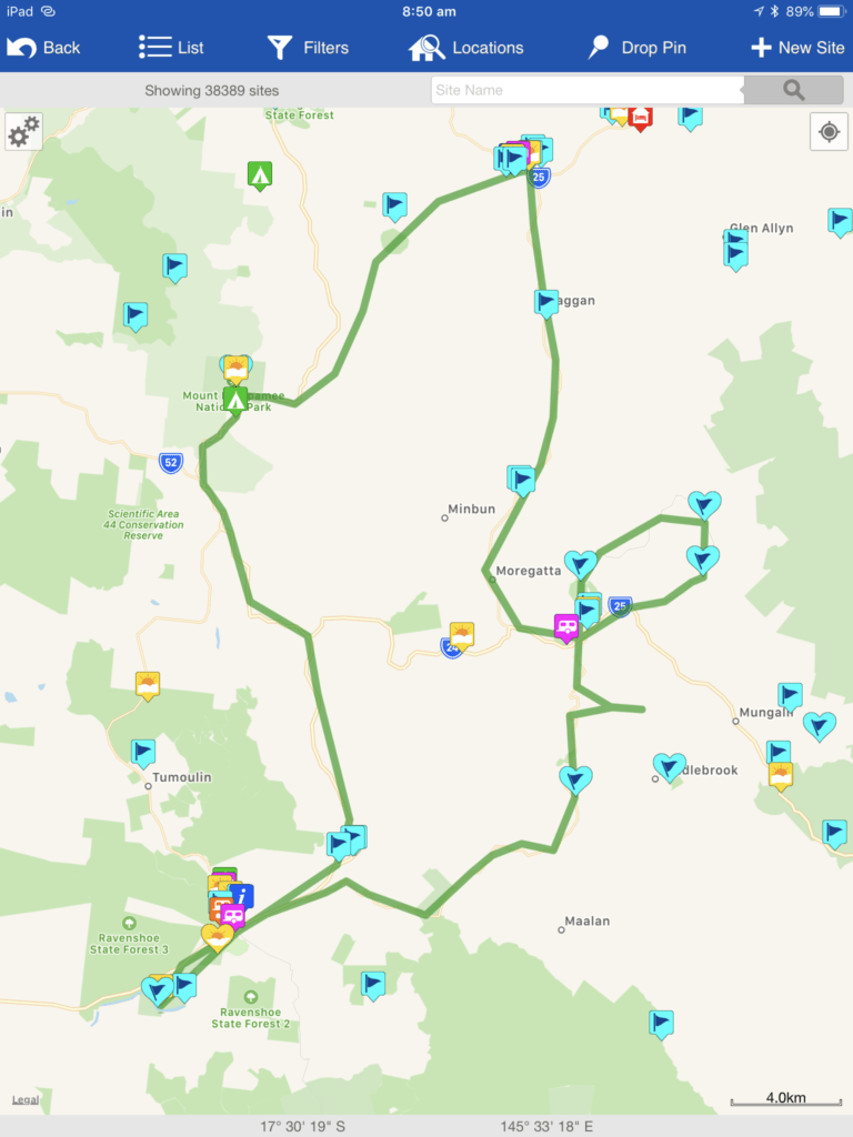
I have also created this map as a guide for you to follow using one my favourite apps for travelling, WikiCamps. Note: All distances quoted are derived from WikiCamps.


To download this app for IOS click here.  For Android click here.

Waterfall 1. Dinner Falls

Mount Hypipamee Crater, Atherton Tablelands Queensland, Queensland Waterfalls, Waterfalls, Great Australian Adventure

Distance from Malanda 17 km


Using the township of Malanda as your base, travel via the upper Barron Road until you reach the Kennedy Highway. From there the turn off to the Dinner Falls is via Crater Road.


The Dinner Falls has an added bonus of an epic ancient crater right next door, so effectively, two wonderful sightseeing options in one. The falls and crater are located in Mount Hypipamee National Park.


Mount Hypipamee Crater

level 2 - 350 Metres - High Path


The high path at first is a very easy concrete walk and could  be wheelchair assessable but it's flawed at the end by no less than ten steps to the viewing platform of the crater.

Dinner Falls, Atherton Tablelands Queensland, Queensland Waterfalls, Waterfalls, Great Australian Adventure

The crater is believed to have been created by a violent gaseous explosion that blasted a deep hole in the earth forming a volcanic pipe or diatreme. The viewing platform is 130 meters above the lake and looks a long way down too. The crater is also believed to be approximately 73 meters deep and is covered in native duck weed giving the lake its awesome green colour.


Dinner Falls

level 6 - 500 Metres - Low Path


From the crater platform, there is also another set of stairs that takes you to the Dinner Falls pathway. I tried this way and had to short cut through scrub to meet the lower pathway below. It was steep, muddy and treacherous at times. I would recommend back tracking along the high pathway until it splits to the lower pathway to see the falls. The pathway overall was muddy and slippery at times due to recent rains which is very common on the Atherton Tablelands.

Waterfall 2 - Millstream Falls - Big

Millstream Falls, Atherton Tablelands Queensland, Queensland Waterfalls, Waterfalls, Great Australian Adventure

Distance from Dinner Falls 33kms

Level 3 - 680 metres return


For leg two of our journey take the road back to the Kennedy Highway and head towards Ravenshoe. Just 5kms west of Ravenshoe is the Millstream Falls on Millstream Falls Road.


Take the sealed, but steep concrete walking track directly from the car park to the viewing platform below. There are many widely spaced steps also along the way.


The Millstream Falls cascades over the edge of a columnar lava flow and is reputedly to be the widest single-drop waterfall in Australia.

Waterfall 3 - Pepina Falls

Pepina Falls, Atherton Tablelands Queensland, Queensland Waterfalls, Waterfalls, Great Australian Adventure

Distance from Millstream Falls 23kms.

Level 3 - 100 metres return


To reach the Pepina Falls head back towards Ravenshoe and take the Old Palmerston Highway towards Millaa Millaa. This road is a very scenic,  winding  and breathtaking beautiful road and is not recommended for vans or cars pulling trailers. Continue along this road until you reach The Pepina Falls.


This waterfall is very close to the road and parking is limited to two or three cars only.  The pathway down is not obvious, it’s a little hidden and overgrown.  It's a very short, but steep decent to the bottom and feels more like a scramble than a walk. Its muddy and slippery right to the bottom.


Although this is a very small waterfall, it is still actually one of my favourites. I think it's because it's quite secluded and you can get reasonably close to the falls also.

Waterfall 4 - Souita Falls

Soutia Falls, Atherton Tablelands Queensland, Queensland Waterfalls, Waterfalls, Great Australian Adventure

Distance from Pepina Falls 7.5kms

Level 2 for falls one - level 5 for falls two


Continue on the Old Palmerston Highway until you reach Millbrook Road and continue 4.5 kms until you reach the falls. Parking again at this waterfall was limited to one or two cars.


There were two falls here. The first one was 110m from the car park, the second 220m.  The first was easily accessibility, via a wide muddy track that ended at a viewing platform. This gave you a view of the top of the falls only.  Most of its drop was hidden as the creek dropped into the shadowy depths of the mini-ravine away from my line-of-sight from the lookout. 


The second one was a slightly more difficult and very narrow at times. It became a steep and muddy walk down the river bank. I did not complete the second fall on this day as I felt the conditions were too treacherous at the time.

Waterfall 5 - Millaa Millaa Falls

Millaa Millaa Falls, Atherton Tablelands Queensland, Queensland Waterfalls, Waterfalls, Great Australian Adventure

Distance from Souita Falls 9.7kms

Level 1 - Wheelchair accessible from the bus/coach car park.


To reach our next falls head back to the Old Palmerston Highway and continue towards Millaa Millaa. Turn right onto the Malanda-Millaa Millaa Road, then left onto Theresa Creek Road.  There are three waterfalls on this 17kms circuit.


The 18.3 meter high Millaa Millaa Falls would have to be the regions most popular falls and the most photographed. From the car park above take the easy 30 or so steps down to the waterfall below. You will find the waterfall set in a lush rainforeest and there is also a lovely grassy picnic area for you to relax and sunbake the day away too.


There is a lower carpark for buses, coaches and wheel chair access. The only one of the eight on this circut to offer this facility to the disabled.


If you are lucky you may spot a Ulyesses Butterfly or a Platypus in the afternoon.

Waterfall 6 - Zillie Falls

Zillie Falls, Atherton Tablelands Queensland, Queensland Waterfalls, Waterfalls, Great Australian Adventure

Distance from Milla Milla Falls 8.1 kms

Level 2 - 200 meters return


Zillie Falls is the second waterfall on the 17 km waterfall circuit along Theresa Creek Road. It is close to the car park and no more than 100 metres to the viewing platform. It's a very easy walk to the viewing platform and would be wheelchair accessible with a little help. You can get a reasonable shot of the falls from far left corner of the platform.


The path that led down to the base of the falls, was muddy, slippery and steep and would have been a long way down. Possibly a level 7 from the little I saw of it. Extreme care would need to be taken to take this path and not after recent rain.

Waterfall 7 - Ellinjaa Falls

Ellinjaa Falls, Atherton Tablelands Queensland, Queensland Waterfalls, Waterfalls, Great Australian Adventure

Distance from Zillie Falls 2.4kms

Level 2 - 240 metres return


Ellinjaa Falls is the third and final fall on the Theresa Road circuit.


The path to the bottom of this 10-15 metres high fall is concrete and downhill the whole way. Approximately 70  large steps in total until you reach the creek bed below.  


The water flows over a series of lava columns and I believe thet there's also a little ledge hidden behind the falls that you can sit on and take in the scenery.


No one was swimming there on the day I visited, but swimming was possible in my opinion.

Waterfall 8 - Malanda Falls

Malanda Falls, Atherton Tablelands Queensland, Queensland Waterfalls, Waterfalls, Great Australian Adventure

Distance from Ellinjaa Falls 29 kms

Level 2 - 100 metres return


The Malanda Falls entrance is right behind the Malanda Falls Visitors Centre on the Malanda-Atherton Road or via a private entrance from the Malanda Falls Caravan Park. There are a few steps involved via either entry to get to the pool at the base of the falls. But viewing of the falls behind the visitors centre is wheelchair assessable.


The North Johnson River is the source of this cascade waterfall and it's prone to significant flooding in the wet season. The pool that directly sits at the bottom had a platypus swimming in it on one of the day we visited also.


Directly across the road from the waterfall there is a unique rainforest walk, where we spotted turtles and an abundant of wildlife including tree kangaroos if you are lucky enough to sight one during your visit.

Annette and Eric Green - Australian Silo Art Trail
We have been travelling Australia in a custom built motorhome since 2018. Through the art of storytelling and photography, we help our readers explore Australia along with us, with the aim to encourage them to get on the road as well.

Feeling Social?

Our Sponsors

Adventures on the road logo
Share by: